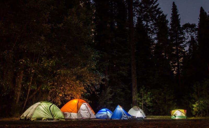
Fort Sage Off Hwy Area
Fort Sage Off Hwy Area is a camping area managed by the Bureau of Land Management (BLM) in California, about 3 miles northeast of Doyle, at roughly 4,722 ft elevation. Sites are informal and first-come, first-served. There are no reported facilities: no toilets, water or trash service, so come fully self-contained. This is a BLM off-highway vehicle area with no facilities, so expect OHV traffic on weekends. On BLM land in California you can stay up to 14 days in any 28 consecutive days, then must move outside a 25-mile radius. A free California Campfire Permit is required for campfires and stoves outside developed campgrounds, and fire bans are common in summer. Check current fees, seasons and road conditions with the managing office before you go. Bring all the water you need. Cell service is reported as limited, so download maps and directions before you lose signal. The nearest town for fuel, groceries and other supplies is Doyle. Road access is rated moderate: most passenger vehicles can manage in dry weather, but conditions change after rain or snow. Plan to arrive in daylight, since informal sites can be hard to spot after dark. Pack out all trash, use existing fire rings where fires are allowed, and leave the site as you found it.
About Fort Sage Off Hwy Area
Fort Sage Off Hwy Area is listed on Camping in the USA as a free dispersed camping area in California on land managed by the Bureau of Land Management (BLM). Its listed GPS coordinates are 40.0600, -120.0730.
At Fort Sage Off Hwy Area, access is rated moderate, overall difficulty is rated moderate and cell service is reported as limited.
No facilities or drinking water are listed for Fort Sage Off Hwy Area, so arrive self-sufficient.
Best seasons listed for Fort Sage Off Hwy Area: Summer.
Within 50 miles there are 8 other listings in our directory (8 dispersed, 0 paid); the closest is Fort Sage OHV Vicinity Dispersed, about 22.9 miles away in a straight line.
Know before you go
- Dispersed sites are first-come, first-served: use an existing cleared spot and follow posted stay limits.
- Check the Bureau of Land Management (BLM) for fire restrictions, closures and permits before heading to Fort Sage Off Hwy Area.
- Bring all drinking water, plus extra for cooking and cleanup.
- With limited cell service reported, download offline maps and leave your plans with someone.
- If Fort Sage Off Hwy Area is full, the nearest listed alternatives are Fort Sage OHV Vicinity Dispersed and Lake Davis Backroads.
Frequently asked questions
Is Fort Sage Off Hwy Area free?
Fort Sage Off Hwy Area is listed as free dispersed camping. Confirm current regulations with the Bureau of Land Management (BLM).
Where is Fort Sage Off Hwy Area?
Fort Sage Off Hwy Area is in California at GPS 40.0600, -120.0730. The nearest other listing is Fort Sage OHV Vicinity Dispersed (about 22.9 miles).
Is there water at Fort Sage Off Hwy Area?
No water source is listed, so plan to bring your own drinking water.
Is there cell service at Fort Sage Off Hwy Area?
Cell service is reported as limited. Coverage varies by carrier.
Are there other campsites near Fort Sage Off Hwy Area?
Yes. Our directory lists 8 other campsites within 50 miles, including Fort Sage OHV Vicinity Dispersed (22.9 mi), Lake Davis Backroads (24.6 mi) and Biscar Reservoir (36.2 mi).
Listing details can change; distances are straight-line. Confirm conditions before you go.
More free camping near Fort Sage Off Hwy Area
The 8 closest listings in California, by straight-line distance.
- Fort Sage OHV Vicinity DispersedFree dispersed camping22.9 mi
- Lake Davis BackroadsFree dispersed camping24.6 mi
- Biscar ReservoirFree dispersed camping36.2 mi
- Gold Lake Highway PulloutsFree dispersed camping39.5 mi
- Plumas NF – Quincy La Porte RdFree dispersed camping45.2 mi
- Tahoe – Jackson Meadows BackroadsFree dispersed camping47.3 mi
- Bowman/Meadow Lake CorridorsFree dispersed camping48.3 mi
- Tahoe – Fordyce Lake AccessFree dispersed camping49.4 mi