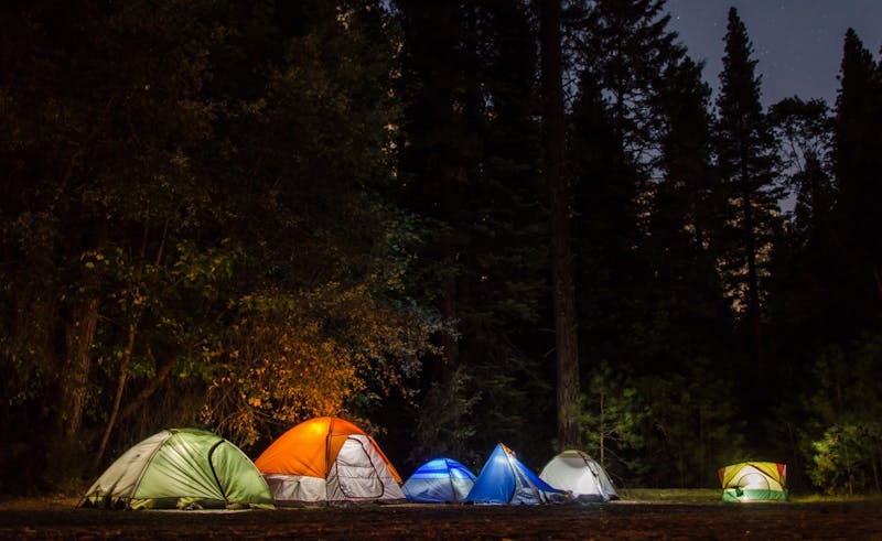
Cherokee NF – Ocoee River & Tellico area
Cherokee NF – Ocoee River & Tellico area sits on land managed by Cherokee National Forest in Tennessee. River gorges & mountains. Pullouts along FR 15 & forest roads. Elevation is around 1800 ft, so plan for the temperature swing that comes with it. Carry a trash bag; everything goes home with you. Haul in your own water; none is listed here. Access is rated moderate, so take it slow on rough stretches. GPS: 35.12, -84.48.
About Cherokee NF – Ocoee River & Tellico area
Cherokee NF – Ocoee River & Tellico area is listed on Camping in the USA as a free dispersed camping area in Tennessee on land managed by the USDA Forest Service. Its listed GPS coordinates are 35.1200, -84.4800. The listed elevation is about 1,800 feet.
At Cherokee NF – Ocoee River & Tellico area, access is rated moderate, overall difficulty is rated moderate and cell service is reported as poor.
No facilities or drinking water are listed for Cherokee NF – Ocoee River & Tellico area, so arrive self-sufficient.
Best seasons listed for Cherokee NF – Ocoee River & Tellico area: Spring and Fall.
Within 50 miles there are 25 other listings in our directory (20 dispersed, 5 paid); the closest is Big Lost Creek, about 2.8 miles away in a straight line.
Know before you go
- Dispersed sites are first-come, first-served: use an existing cleared spot and follow posted stay limits.
- Check the USDA Forest Service for fire restrictions, closures and permits before heading to Cherokee NF – Ocoee River & Tellico area.
- Bring all drinking water, plus extra for cooking and cleanup.
- With poor cell service reported, download offline maps and leave your plans with someone.
- If Cherokee NF – Ocoee River & Tellico area is full, the nearest listed alternatives are Big Lost Creek and Chilhowee Rec Area.
- This listing says to pack out all waste.
Frequently asked questions
Is Cherokee NF – Ocoee River & Tellico area free?
Cherokee NF – Ocoee River & Tellico area is listed as free dispersed camping. Confirm current regulations with the USDA Forest Service.
Where is Cherokee NF – Ocoee River & Tellico area?
Cherokee NF – Ocoee River & Tellico area is in Tennessee at GPS 35.1200, -84.4800. The nearest other listing is Big Lost Creek (about 2.8 miles).
Is there water at Cherokee NF – Ocoee River & Tellico area?
No water source is listed, so plan to bring your own drinking water.
Is there cell service at Cherokee NF – Ocoee River & Tellico area?
Cell service is reported as poor. Coverage varies by carrier.
Are there other campsites near Cherokee NF – Ocoee River & Tellico area?
Yes. Our directory lists 25 other campsites within 50 miles, including Big Lost Creek (2.8 mi), Chilhowee Rec Area (7.7 mi) and Cottonwood Patch (13.1 mi).
Listing details can change; distances are straight-line. Confirm conditions before you go.
More free camping near Cherokee NF – Ocoee River & Tellico area
The 8 closest listings in Tennessee, by straight-line distance.
- Big Lost CreekFree dispersed camping2.8 mi
- Chilhowee Rec AreaPaid campground7.7 mi
- Dam CreekFree dispersed camping24.1 mi
- Davis BranchFree dispersed camping24.3 mi
- Big Oak CoveFree dispersed camping24.3 mi
- Cherokee – Citico CreekFree dispersed camping37.7 mi
- Big South Fork BackroadsFree dispersed camping92.4 mi
- BSF NRRA – Blue Heron VicinityFree dispersed camping107.3 mi